What is Queen Elizabeth National Park famous for? Queen Elizabeth National Park it is located…
Rwanda hiking safaris
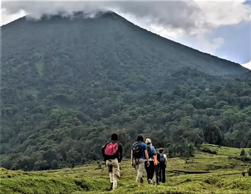
Rwanda hiking safaris : For adventure-seeking tourists, mountaineering in Rwanda offers the most gratifying mountain climbing and trekking experiences. One of the most popular safari sites for gorilla safaris is Rwanda, which is located in East Africa south of the equator. However, the nation has more to offer than just gorilla safaris. The “Land of a Thousand Hills” is a website that lists the top hiking excursions for hikers of all skill levels.
In Rwanda, mountaineering, also referred to as volcano hiking, is frequently practiced in the Virunga Volcanoes. The Virunga Massif, which has eight magnificent volcanoes, is most heavily concentrated in Rwanda, where it is home to five of them: Mounts Bisoke, Karisimbi, Sabyinyo, Muhavura, and Gahinga. Nevertheless, aside from Mount Sabyinyo with its jagged edges and enormous craters, mountaineering trips are popular on 4 of these volcanoes. However, it is possible to ascend this volcano from Uganda.
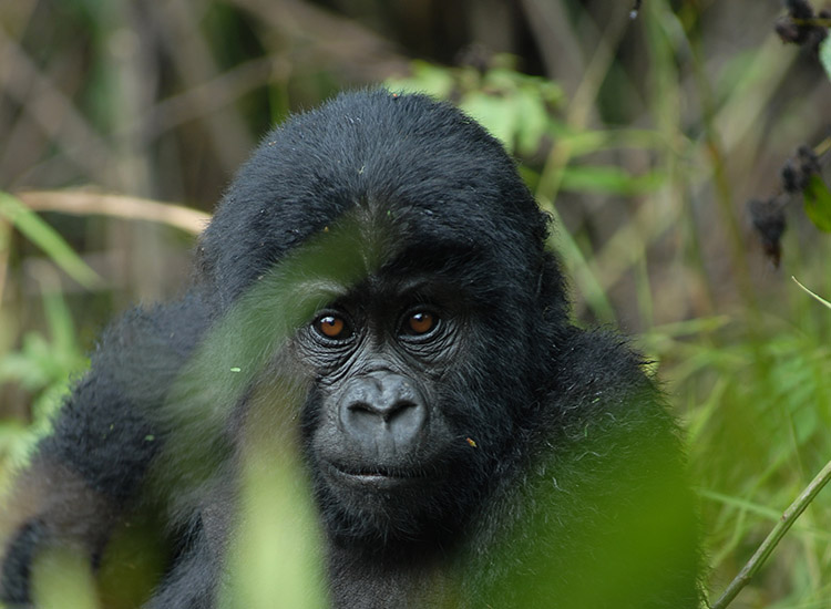
Additionally, all five of these volcanoes are located within the Volcanoes National Park, one of Rwanda’s most well-known national parks and a popular destination for hiking and gorilla trekking. The Virungas are a haven for nature lovers, featuring lush, deep forests, a variety of plant zones, breathtaking scenery, stunning crater lakes, breathtaking scenery, and peculiar montane life. A wide variety of endemic birds, forest elephants, buffaloes, golden monkeys, mountain gorillas, and other primate species can be found in the mountains. A large portion of this incredible wildlife is native to the Virunga Mountains or the Albertine Rift Valley, where the mountains are situated. Here are a few of Rwanda’s top places for mountain hiking;
MOUNT BISOKE
Mount Bisoke, an active volcano that towers 3,711 meters (12,175 feet) above sea level and situated on the border of Rwanda and the Democratic Republic of the Congo, has its summit in Rwanda. The volcano is located next to the well-known Lake Kivu and approximately 35 kilometers northeast of Goma town. Despite being active, Mount Bisoke is said to have last erupted in 1957. Lake Ngezi and one other crater lake were created during this eruption.
Although mountaineering in Rwanda’s Mount Bisoke is not just for experienced hikers, it is an interesting and adventurous experience that calls for high fitness. Depending on how frequently the hiking party stops for rest, the trek to the peak takes 6 hours, with 4 hours for the ascent and 2 or more hours for the descent. On the other hand, experienced mountaineers can get there in 3 hours.
Two trails—the Lake Ngezi trail and the Mount Bisoke Crater Lake track—are used for mountaineering expeditions up Mount Bisoke. The most well-known hiking route in Volcanoes National Park leads to the spectacular crater lake at the summit of Mount Bisoke. Mountain Bisoke, which is even closer to the Virungas’ heart, offers fantastic views of the entire mountain range. Additionally, you can see Mount Mikeno’s steep summit in the Congo. While hiking, hikers have a good chance of seeing animals like mountain gorillas and golden monkeys, among others.
Contrarily, the Lake Ngezi trail offers a quicker ascent of Mont Bisoke and is the best option for people who do not want to reach the peak. On the side of Mount Bisoke, next to Mount Gahinga, is the magnificent crater lake known as Lake Ngezi. Depending on your level of fitness, the round-trip hike takes 4 to 5 hours.
MOUNT KARISIMBI
The highest Virunga volcano, Mount Karisimbi, rises 4,507 meters (14,787 feet) above sea level. Within Volcanoes National Park, close to the border with the Democratic Republic of the Congo, is the dormant volcano. The mountain produces snow throughout the dry months of the year due to its close closeness to the equator. The term Karisimbi, which in the native Kinyarwanda language means “white shell,” is where Mount Karisimbi gets its name. This mountain features a two-kilometer-wide Branca Caldera, two craters, the largest of which is the Mutango crater.
In contrast to the other volcano treks, Mount Karisimbi is a two-day adventure that includes one night of camping on the summit at an elevation of 3,700 meters. This volcano climb is recommended for experienced hikers who prefer a longer and more challenging journey in the Virungas. A trip up the mountain is frequently combined with gorilla trekking by visitors to Rwanda’s Volcanoes National Park. Hikers can expect to observe a variety of birds, golden monkeys, and even mountain gorillas during this potentially difficult but rewarding journey. In addition, one can visit the grave of Dian Fossey, a well-known primatologist who studied mountain gorillas in depth.
Since this is the best time to explore the deep, foggy forests of the Virunga Mountains, I recommend climbing Mount Karisimbi in the early morning hours of June through early October. Mountain hiking tours on Mount Karisimbi can be scheduled through a local tour operator, who would then be in charge of arranging accommodations, meals, and other mountaineering equipment as well as securing permits. On your mountaineering in Rwanda safari, porters are available to assist with carrying your bulky equipment for about $20 per hour.
MOUNT GAHINCA
The shortest of the Virunga Volcanoes, Mount Gahinga is located on the border between Rwanda and Uganda and is 3,474 meters above sea level. The smallest of the three volcanoes, Gahinga is situated between Mount Muhabura and Sabyinyo. The name of the volcano is a Kinyarwanda expression that is also translated as “a small pile of stones.” The volcano may be found in Uganda’s Mgahinga Gorilla National Park, which also takes its name from it. On its top, the volcano has a swampy caldera that is 180 meters (591 feet) wide.
Although Mount Gahinga is a less strenuous hike than Mount Sabyinyo or Muhabura, it still requires mental and physical preparation to climb the volcano. Depending on the hiker’s fortitude and level of fitness, Mount Gahinga provides exhilarating day treks that can be completed in as little as six hours. Adventures by foot to Mount Gahinga start at 7:00 a.m. with a briefing from a park ranger at the park’s administrative center. Here, hikers are given information about the mountain’s history, location among the Virunga volcanoes, as well as what they should pack for the journey. The climb up the stunning mountain starts following the briefing.
Enjoy the dense bamboo forest cover with breathtaking views of monkeys, baboons, buffaloes, etc. from the lower slopes. The most stunning views in the massif can be found at the peak. There are several sights to take in, including the vast crater wetland, the Virunga ranges, and the distant views of the Rwenzori Mountain Ranges. As you climb higher, you will come across multiple bat-filled volcanic caves.
One needs a hiking permit from the park authorities in order to go mountaineering on Rwanda’s Mount Gahinga. On the day of the hike, permits can be acquired for $75.
MOUNT MUHABURA
Mount Muhabura is the third-highest volcano in the Virunga Massif and is located in both Volcanoes National Park and Mgahinga Gorilla National Park. Its elevation is 4,127 meters. There is a small but lovely crater lake at the peak of the inactive volcano. The name “Muhabura,” which in Kinyarwanda means the guide, is also used for Mount Muhabura. Both Rwanda and Uganda provide hiking opportunities to Mount Muhabura. The Virunga Massif’s Mount Muhabura is the toughest mountain to climb, nevertheless. Although it isn’t the tallest, the hike must be finished in one day because it is so steep. The volcano has a cone-like shape, and its slopes and base are both covered in volcanic ash and other related elements. The thickets and plants that develop on the mountain slopes are supported by the volcanic ash.
The 6- to 8-hour Mount Muhavura trek offers breathtaking vistas of the untamed landscape. Burera and Ruhondo, which are twin lakes, can be seen by looking down. A magnificent crater lake can also be discovered close to Mount Muhavura’s summit. Hiking on Mount Muhabura requires good fitness and endurance due to its elevation.
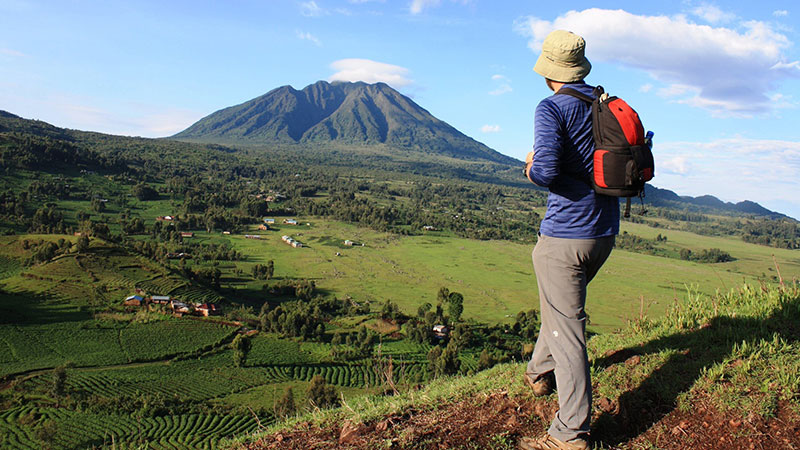
You must purchase a permit at the Kinigi Visitors Center if you plan to hike Mount Muhabura from the Rwandan side. Your group will be assigned a Guide and Rangers who will lead you up the mountain after you pay at the office. Prior to starting the hike, the Rangers will take the hikers through. This introduction provides all facts and information about the hike and mountain. Amounting to an 8 to 7 hour hike, Mount Muhabura starts at around 7 a.m. If you need assistance moving heavy equipment or luggage, porters are available for hire at the mountain’s foot.
What Time of Year Is the Best for Hiking in Rwanda?
Whether it’s the wet or dry seasons, hiking in Rwanda is a thrilling safari experience that can be had all year round. However, there is less rain and more sunlight during the dry seasons, which last from June to September and December to February. The hiking trails are dry and simple to ascend, making this the perfect time to explore. The pathways become quite muddy and the hike is difficult during the rainy months (March to May and October and November), which are characterized by frequent rainstorms with torrential downpours.
But the best time to view the landscape is during the rainy season, which may also be the best time to mountaineer if you’re up for the challenge of a strenuous Hiker in Rwanda tour.
Packing List for a Mountaineering Safari in Rwanda
Suitable hiking shoes for the Virunga Massif’s challenging mountainous terrain
Long pants, long-sleeve shirts, a rain jacket, and warm stockings are some examples of warm apparel. Gloves for the hands
A walking stick (typically available at the park’s administrative center)
Sunscreen and insect repellant
A few snacks and some water
A nice camera to take the best memories’ photographs
A set of binoculars to aid in getting a clearer and farther-reaching perspective.
Camping gear for hiking sites like Mount Karisimbi, such as a tent, sleeping bag, sleeping pad, etc.

